Open the panel, then press Run to load Python. You can stop execution and reset parameters. Results are computed on this device. No Python installation is required.
Local execution steps below are optional for reproducing the source results; they are not required for the browser experiment.
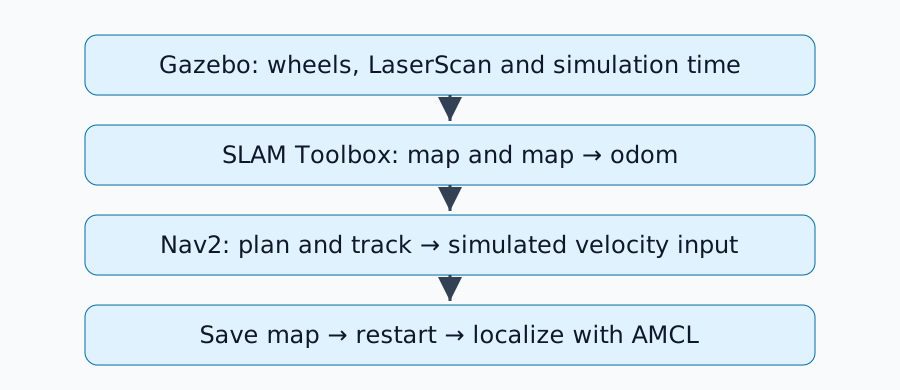
Change the controls above and compare A/B results. No ROS installation is needed. This exercise checks a fixed synthetic map and supplied points; it does not run SLAM, AMCL, Nav2 or Gazebo. The real-runtime procedure below is optional.
Try mapping, then saved-map mode. Mapping uses an already prepared grid: no observations update it. Saved-map mode requires the modeled image/YAML pair; choosing either file alone hides the map and makes occupancy checks unavailable. These are prepared file-availability cases, not a save operation or an image/YAML parser. Both modes use the same fixture. The expected map→odom owner changes from SLAM to AMCL. Duplicate or missing publishers are independent configuration warnings; no transform is executed. odom→base_link is assumed to have one odometry source.
The grid contains 12 × 10 cells, resolution 0.5 m, origin (−1, −1) m and origin yaw 0. Values are 0=free, 100=occupied and −1=unknown in this fixture. Cells are stored with x changing fastest, starting at the bottom-left; the display flips y for the screen. Coordinates are in the map frame. Column=floor((x+1)/0.5), row=floor((y+1)/0.5); the map covers −1≤x<5 and −1≤y<4. A point exactly on an internal boundary belongs to the cell above/right. The data download retains cell indices and values. Gray question marks are unknown cells, not free space.
The blue circle/heading is a supplied pose, not a localization estimate or ground truth. In saved-map mode it represents an initial-pose seed; a supplied seed does not establish convergence. Heading is counterclockwise from +x. The red cross is a goal point without a goal orientation. With no pose supplied, distance and pose occupancy are unavailable. Straight-line distance is Euclidean separation between supplied points, even when outside the map; it is not path length. The default points are free but the straight segment between them crosses a wall. No segment, connectivity, footprint, inflation, collision, path or arrival check runs. Passing the independent checks is not proof of navigation readiness.
Use the unknown, occupied and outside presets to see distinct goal states. A free cell alone does not establish footprint clearance or reachability. A/B starts fresh and preserves the fixed map and coordinate scale. No uploads, map saving, sensor simulation or real-device performance are included.
评论
请先登录。
暂无数据。